


 Hi Everyone,
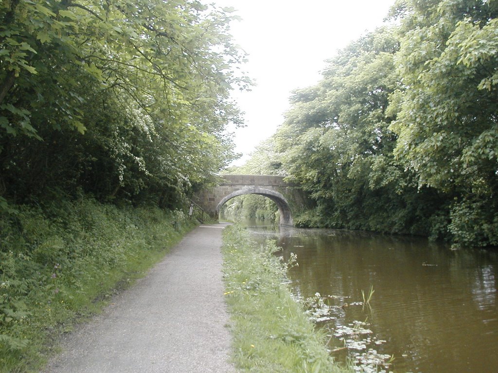 As some of you are aware I have taken to having a long walk at lunchtime when work and weather permit. Although not glorious sunshine it was a nice day today and I made time for this walk down the Lancaster Canal. For those of you unfamiliar with canals they were the original motorways. Used for transporting goods and people in barges, towed by a horse - hence towpath, as seen in this first picture.
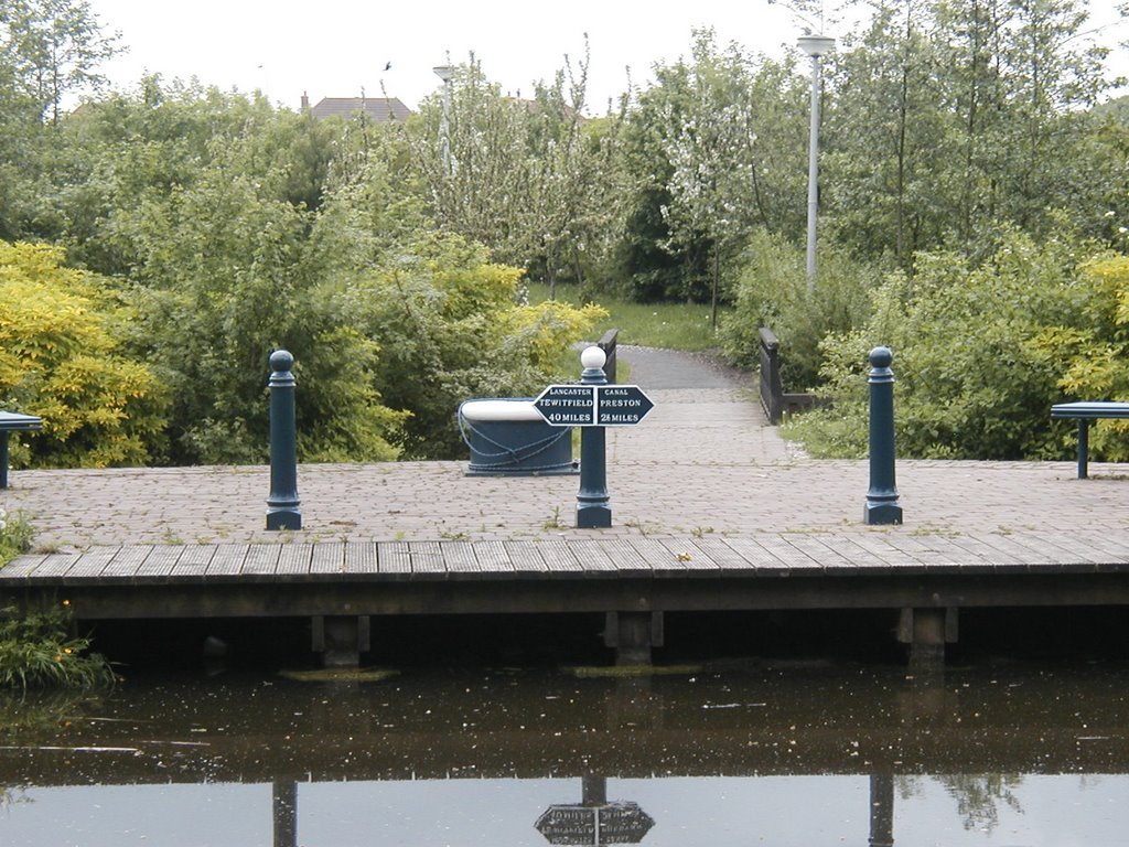 These area was about two miles away from the nearest house when I was a kid, so 2 miles every 30 years!

 The road bridge is a recent road built to encircle Preston - called Tom Benson Way - after a local record breaking long distance walker. It's odd there was only grafitti on this one surface, all the others were grafitti free. I'm really against grafitti, but here I just thought - whats worse a concrete wall or a colourful wall! I think maybe it wasn't menacing like some grafitti is, maybe if it was a dark night, etc. etc.
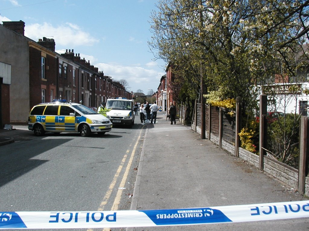 I was just driving past the end of this road on the way to my local branch of the TSB, which I had visited yesterday, but had been given the incorrect amount by £80, which the bank informed me they had found when they cashed up for the night, when I saw this commotion, I'd already seen the police helicopter hovering, like a scene from Goodfella's. The van in the picture is waiting to take away the last of four robbers, the suspect is being held down a small ally to the right of the man on the right.
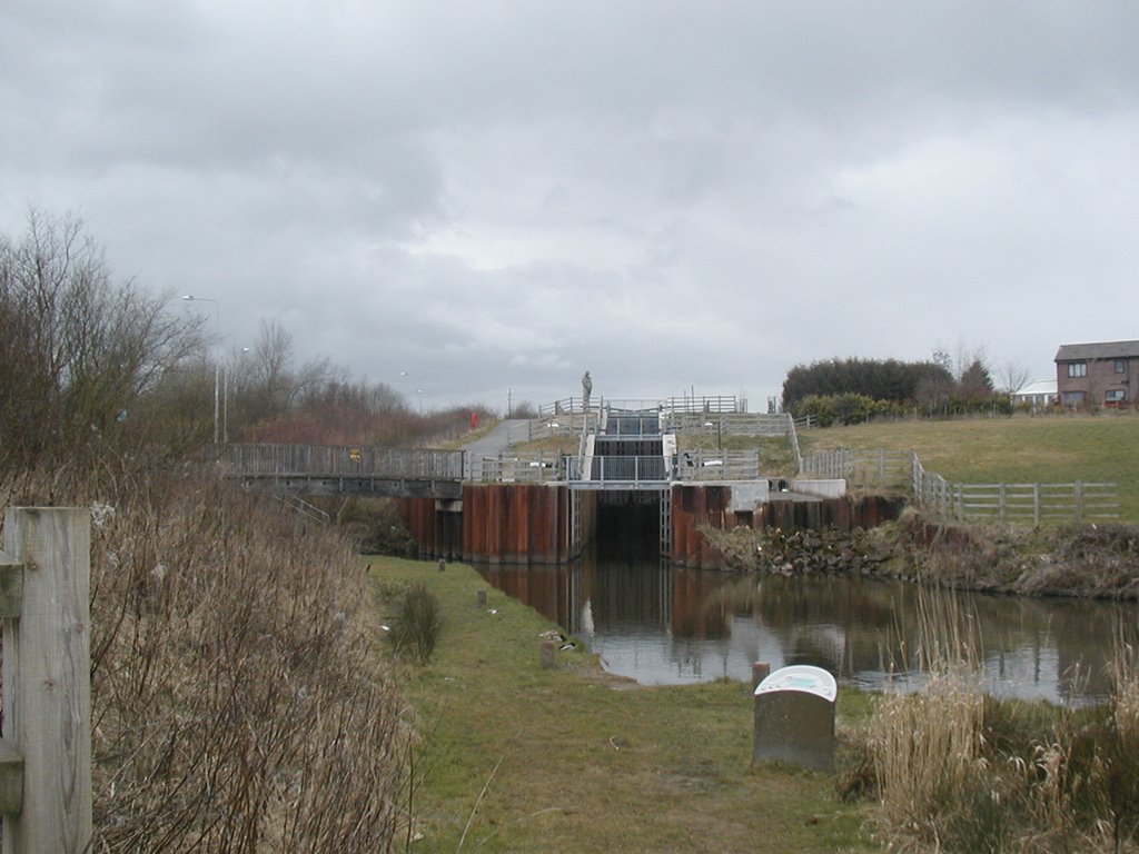
 The Millennium Link is the name given to a recently constructed canal link, joining the Lancaster Canal to the River Ribble. Prior to this any boats on the Lancaster Canal could only access the rest of the canal network by travelling in open sea for about 40 miles! Via Glasson Dock.
 This is surely a sign that Spring is here, taken in the second of two public parks within an easy walk of my home. This one is, looking at my map icon, bottom left, a small bit of pink just visible. It's called Ashton Park and is actually larger than Haslam Park.
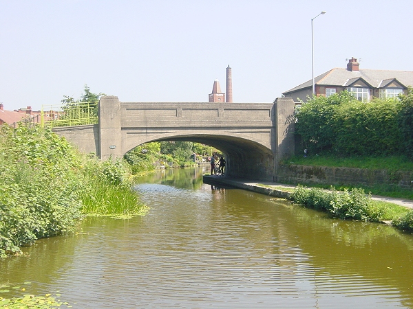
 Today's journey along the banks of the Lancaster Canal will give you an alternative view of the road bridge on the masthead of my blog, you can see from this angle the mill and chimney in the bankground. This obviously used to be a cotton mill, then a warehouse for a catalogue company and I believe at present it's a call centre. I think one day it will be converted into apartments, just like a similar building has been in Preston centre.
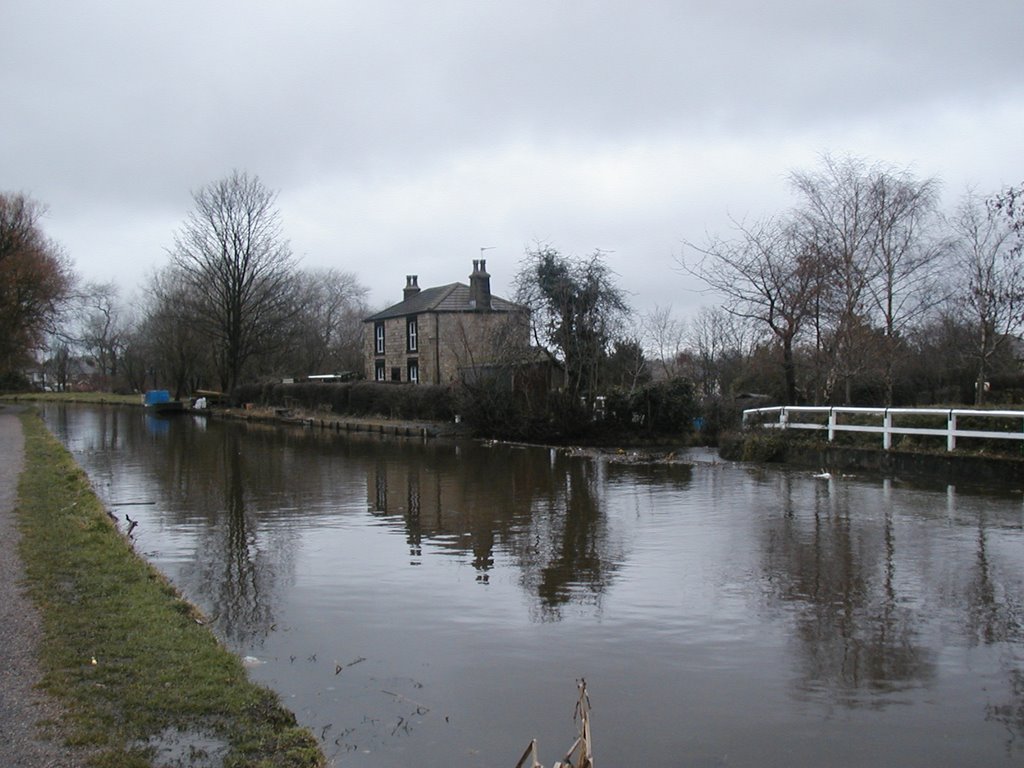 If you imagine the position this photograph was taken from and then turn to your left 180 degrees you will see the next photographic view, this shows the old cottage, traditionally inhabited by someone who work for the water board, you can see the blue barge in the distance. Right at the left of the photograph where the canal passes out of view is a large stream that passes beneath the canal, one of my neighbour's gardens are at this junction, so in effect if you could see past the building in the top left corner you would see my house.
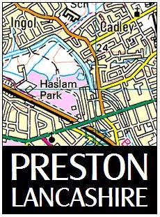 I hope you all like the new design, it's taken a while to get it just how I like it. The map shows the area that I've spent the last 43 years in.